DotWatcher.cc


Embarking on a Fastest Known Time (FKT) cycling attempt, especially on remote, bikepacking trails like the Tour Divide or the Highland Trail 550, requires thorough planning. In this guide, we'll delve into the practicalities of preparing for your FKT journey using the Ride With GPS platform. It’s everything you need to know, from the initial scrutinizing of trails to heading out on your attempt day.
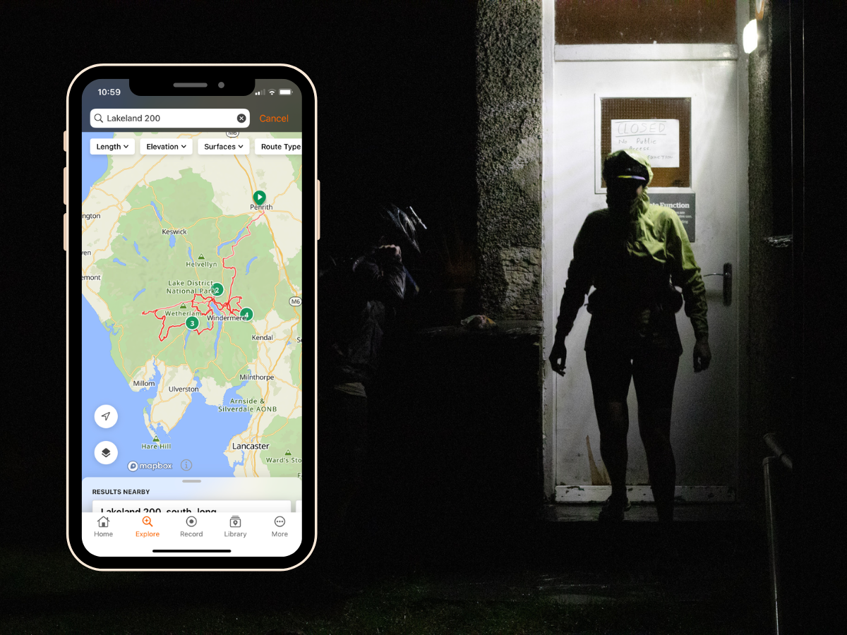
The images included are from the Steezy Collective Lakeland 200 Project by Kitty Dennis, supported by Ride With GPS.
Researching Your Route
Effective route planning starts with a blend of digital mapping tools and online research. Ride With GPS provides a valuable initial overview, and you can use the platform to search for, and study, previous FKT attempts by other riders. Download the official route GPX from the relevant source and upload it to your route planner, this will allow you to further study the route.
Complement this with an online search to uncover potential challenges such as the trail rules, or things like the number of gates or water crossing. A well-informed approach ensures you're prepared for obstacles that could significantly impact your FKT strategy.
A great anecdote for pre-research is the Arizona Trail, where riders are required to carry their bikes across the Grand Canyon. This is almost a marathon in length, carrying a bike. The traverse can take a minimum of half a day and up to three days, with only pre-booked sleep stops allowed.
If needed, sign up for a free Ride With GPS account .

Checking Elevation Against Distance
Use the elevation profile inspect tool for visualisation, couple this with knowing how your performance stacks up at different elevations will factor in as you plan. Compare previous similar rides that you’ve done in your collection and assess your pace at different elevations, how did the exertion feel? Not only does it affect pace, it affects your morale, and your legs and is itself affected by weight. Hilly ride? Maybe consider packing light and come up with an effort management plan. This awareness allows for thorough planning, making sure you adapt your pace and timing as well as energy expenditure accordingly to tackle ascents and descents effectively.

Checking the Terrain
Assessing the terrain is so important for estimating overall speed and ride duration. Use Ride With GPS to examine the route trace and elevation chart, with the terrains overlaid it can give you an idea of how different terrains will influence your progress. Whether it's smooth roads or rugged trails, recognizing the impact on your speed allows for thoughtful planning and realistic expectations of the journey ahead. However, you’ll need to dig a little deeper using Street View to see how lumpy the terrain is, if this isn’t available, look up the specific trail online.
For example, a route like the Colorado Trail Race will have significant walking sections, whereas something like the South Downs Way may be more rideable despite both being hilly off-road routes.

Adding Points of Interest (POIs) and Custom Cues
Maximize your route planning efficiency by utilising Points of Interest (POIs) on Ride With GPS. Incorporate up-to-date information for essential stops like food and water refuelling, bike shops, and potential rest spots. Make sure you know the opening hours, and if your spot has seasonal openings and any restrictions. Make use of the Description box on the POI to add detailed information including operating hours, contact info and directions from the trail. This guide ensures you're not panicking mid-attempt to find food, water or a spare tyre.
Custom Cues, recognised on GPS devices and the Ride With GPS Mobile App, can be added for POIs or even significant milestones. This will allow your chosen device to count you down to the desired cue, adding a level of adjustable insight for your ride.
However, if you are left without a paddle and need to head somewhere, use Ride With GPS’ new tool, QuickNav, to get yourself as quickly as possible to your desired pitstop.

Comparing Previous Attempts
Take a look at previous FKT attempts on Ride With GPS using the Explore search, take a look at their ride, their pace and what key points seem to be the make or break of the attempt. However, you’ll need to consider both data and description. Explore comments and stories from past riders via ride descriptions, social media and blogs. Find out if any specific part was challenging or whether certain refuelling points are crucial. This holistic approach creates a well-informed plan for your own FKT attempt, learning from those who have navigated the trail before.
Think of previous attempts as a guide of what, and what not to do, and the Route as the key to deciphering it. Using the two tools in tandem will be a way to confirm all your previous research.
Choosing the Right Time of Year
Selecting the optimal time for your FKT attempt involves evaluating changing trail conditions and the popularity of the route throughout the year. Understand the seasonal variations, considering their impact on the terrain and overall trail accessibility. Wet seasons can wash away trails, but more importantly can make water crossing physically impossible. Equally, dry spells may lead to a loss of any water for drinking or make muddy trails hard-packed.
On the day check the weather forecast. Don’t just trust a single source, with multiple weather stations and different analytic tools there’s often great variation. Pack according to the expected conditions, preparing for wet weather with waterproof gear and ensuring sun protection with sunscreen and extra water for sunnier stretches. Or potentially, postpone your attempt for more favourable conditions. As a rule of thumb, pack for the most pessimistic weather forecast and hope for the most optimistic!
If a winter FKT is on the horizon, be prepared for specific challenges such as snow-covered trails and colder temperatures. Ensure you have the appropriate gear and plan your route to navigate winter conditions successfully. The Winter FKT is a whole different ball game but something that may appeal to the seasoned adventurer.

Using Your Route Plan on Your FKT Attempt
Now that you've decided to head out on your FKT, make sure the route is downloaded to your cycling computer, ensuring the basemaps, with contours, are also pre-loaded onto your device. Some riders may even carry a spare GPS device, without the route there is no way to continue! We’d also recommend a paper map if you’re heading out to extremely remote areas with a compass, and know how to use them in an emergency. You should also have a physical checklist of POIs, climbs and important turning points on a piece of paper as a last resort.
Additionally, have the Ride With GPS app on your smartphone with the route downloaded (do this at home before you leave). This allows you to check POIs, track progress, and even anticipate upcoming climbs or changes in terrain while you're out on the trail. Having your route plan easily accessible ensures you stay on track and adapt to the dynamic conditions of your FKT attempt.

Planning and executing a Fastest Known Time cycling attempt requires a holistic approach. Ride With GPS is a valuable tool throughout the process, helping you navigate the route planning and terrain analysis. By combining data from Ride With GPS, online trail information and stories from the road, you'll be well-prepared for the challenges of your FKT journey. Good luck with your adventure!